Research & projects

Autonomy in context.
Impact in the world.

Six research threads follow mobility end to end, from how vehicles see to how communities move.

01

Robust driving

Driving plans that hold up.

Haohua Que

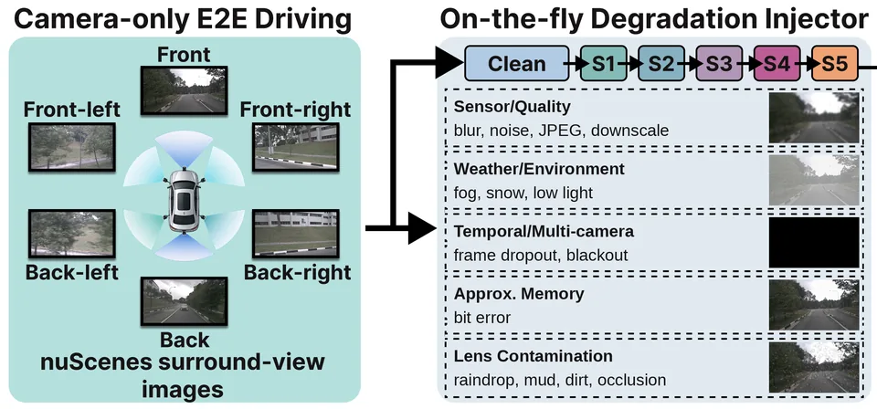
We benchmark how camera corruption affects camera-only, end-to-end driving, find where planning starts to break down, and test in closed loop how much degradation a policy can tolerate. For vision-language planners, we sample candidate trajectories and verify them to pick better plans.
  • End-to-end planning
  • Camera-corruption benchmarks
  • Trajectory verification
  • Closed-loop testing
02

Efficient onboard perception

Perception that fits on the vehicle.

Haohua Que · Tianle Zhu · Qianyi Wu

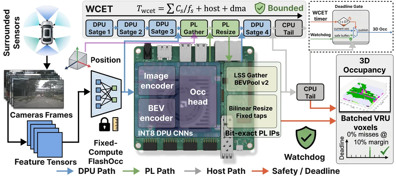
Vehicles have limited power and strict deadlines. We plan from a few calibrated camera queries instead of a dense bird’s-eye view, run camera-based occupancy networks on FPGAs with latency that can be certified, and cut the energy of neural perception with motion-aware approximate memory.

  • Sparse planning queries
  • FPGA acceleration
  • Latency certification
  • Approximate memory
03

Cooperative V2X perception

Vehicles that see beyond themselves.

Tianle Zhu · Haohua Que · Qianyi Wu

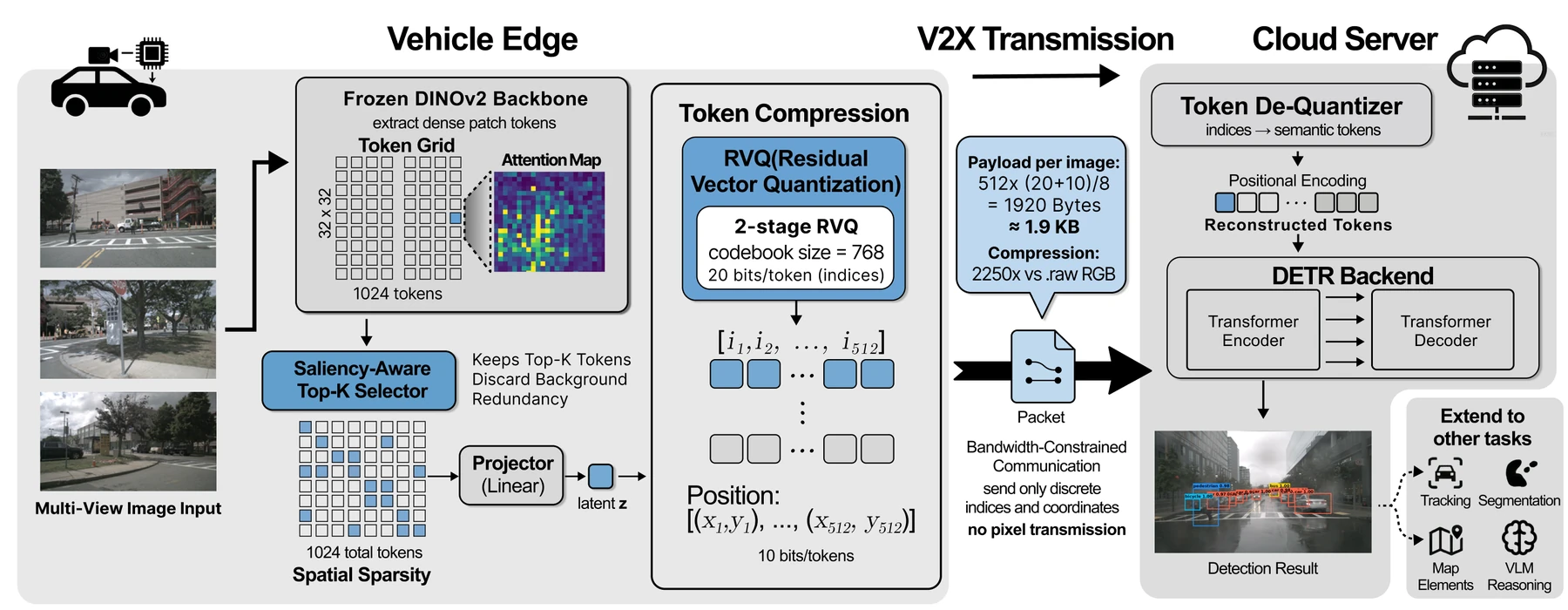
Vehicles and infrastructure can share what they see over V2X, but bandwidth is limited. We compress shared perception into compact tokens and use cloud-assisted encoding with large multimodal models to keep collaborative perception efficient.

  • Token compression
  • LMM-based encoding
  • Cloud–edge collaboration
04

3D scenes & robot exploration

Understanding places. Navigating possibilities.

Haohua Que · Tianle Zhu

We regress 3D Gaussian scenes from RGB images and poses alone, localize and render large-scale scenes with mixture-of-experts coordinate encoding, and help robots explore and navigate by predicting the scene ahead.

  • 3D Gaussian splatting
  • Predictive exploration
  • Scene-coordinate localization
05

Vehicle behavior in traffic

How automated and electric vehicles really drive.

Tianle Zhu · Qianyi Wu · Richard Fritz

Field experiments and open datasets show how electric vehicles with one-pedal driving follow other cars, and how driver-assistance and automated driving systems interact with traffic lights and signs. We also study edge-computing operations for automated vehicles at stop-controlled intersections.

  • Field experiments
  • Car-following models
  • Interaction datasets
  • Edge computing
  • Network simulation
06

Rural roads, ready for autonomy

Safer roads. Stronger communities.

Tianle Zhu · Haohua Que

Through TRAVELS and related projects, we assess whether rural roads are ready for automated vehicles, map Georgia demonstration routes with LiDAR and HD maps, and synthesize the evidence on rural automated-vehicle deployment.

  • LiDAR HD mapping
  • Readiness assessment
  • Community engagement
  • Evidence synthesis

Try it · Traffic waves

Where phantom jams
come from.

Twenty-two cars on a ring road, no bottleneck. Tap the brakes,
watch the slowdown ripple backward, then add automated vehicles.

Each dot is a car’s position over time; red bands are stop-and-go waves moving backward.

Automated vehicles

Simulated at three times real speed. Human drivers follow the Intelligent Driver Model with a 0.6-second reaction delay; automated vehicles hold the average speed and keep a buffer, as in ring-road field tests.
Sugiyama et al., 2008 Stern et al., 2018

Where we work

From campus
to rural roads.

Map of Georgia with the lab’s home in Athens, the GA-72 experiment route, and the Hawkinsville rural route1 Athens2 GA-723 Hawkinsville
State outline: Natural Earth (public domain). Atlanta is shown for reference.
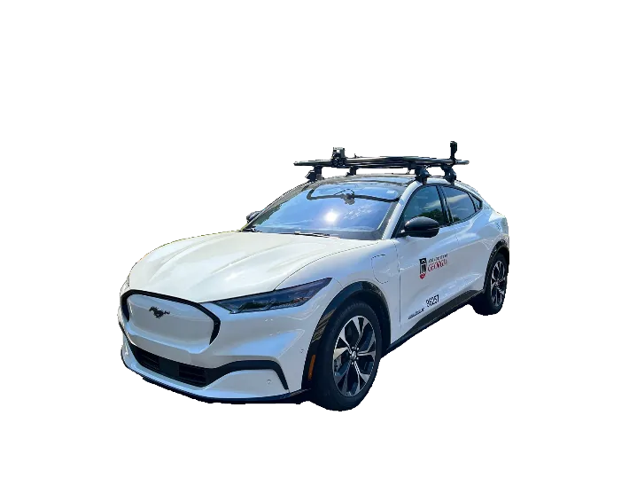
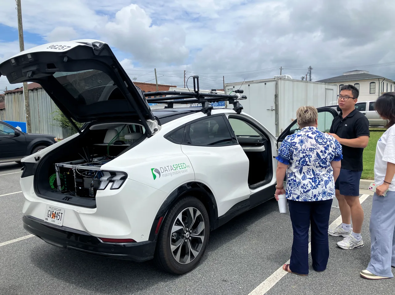
Sensor-equipped UGA research vehicle

01 · Home base

Athens

The lab’s home at the UGA College of Engineering: research, instrumented vehicles, and student projects.

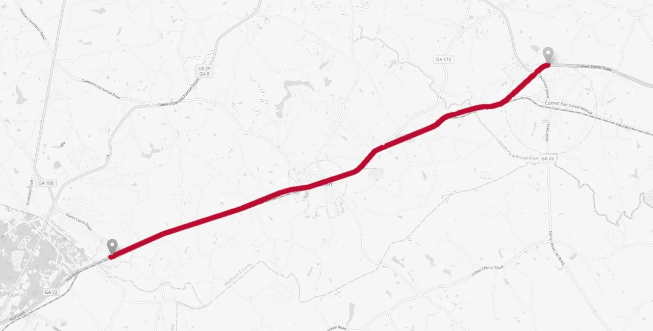
Map of the GA-72 experiment route between Hull and Comer

02 · EV experiments

GA-72, Hull to Comer

EV platoon experiments on a straight, low-traffic stretch of State Route 72, comparing one-pedal and two-pedal driving.

UGA researchers and local officials beside the research vehicle in Pulaski County

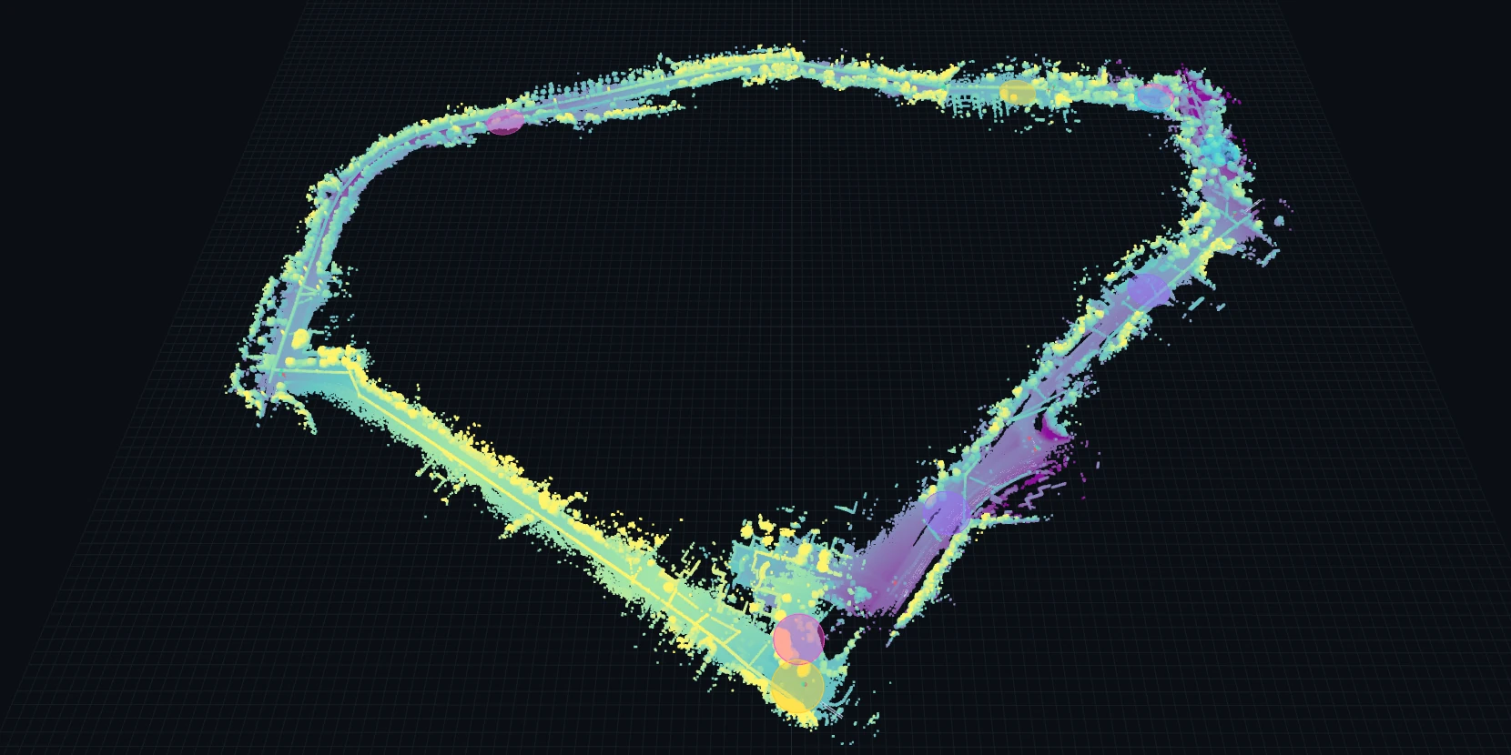
03 · Rural AV route · TRAVELS

Hawkinsville

A 3-mile demonstration loop past the regional hospital in Pulaski County, surveyed with LiDAR and mapped lane by lane.

Applied research

Projects & initiatives.

Research across vehicles,
roads, campuses, and communities.

01

Tribal & Rural Autonomous Vehicles for Efficiency, Livability and Safety (TRAVELS)

USDOT2026–2032

Connect rural mobility needs with autonomous passenger-service concepts, route assessment, and demonstration planning.

UGA contributes the Georgia site work within the UW–Madison-led TRAVELS program, including local engagement and high-definition mapping.

  • Pulaski County stakeholder visit and mapping data collection in July 2026.
  • Public Hawkinsville route viewer with a Lanelet2 map, LiDAR point cloud, and infrastructure challenge annotations.
  • Candidate service routes for everyday trips, healthcare access, and community recreation.
02

Creating a Ten-Year Traffic Safety Infrastructure Plan for the University of Georgia

USDOT2026–2028
03

Rural Road Infrastructure Assessment and Enhancement for Autonomous Vehicle Deployment

USDOT CR2C22025–2026

Assess how rural road markings, signs, and digital connectivity support vehicles with driver assistance and automated driving systems.

A joint North Carolina A&T–UGA project led by Tesfamichael Getahun, with Handong Yao and Qianwen Li as investigators.

  • Camera, GPS, and 5G measurements planned across rural roads and test facilities in Georgia and North Carolina.
  • Planned infrastructure readiness reports and visualizations to help prioritize improvements.
  • UGA study on commercial low-level autonomous vehicles accepted at ASCE ICTD 2026.
04

Realistic Autonomous Vehicle Behavior Investigation for Stakeholder Empowerment (RAISE)

FHWA2024–2027
05

Infrastructure & Movement Pressure Analysis for Campus Travel (IMPACT)

UGA Data Dawg2026
06

Safe and Futuristic Ecosystem for Vulnerable Road Users (SAFER)

UGA2024–2025

Data & demos

Research you can
explore and reuse.

Browse rural-route maps, EV experiment data, and our rural AV evidence hub.

Explore data & demos